A super El Niño is starting. Here’s what scientists know – and don’t
Forecasters are bracing for an El Niño that could become the strongest on record and drive global temperatures and weather extremes to new highs, especially in 2027.
El Niño is a natural swing in the climate system. Human-caused climate change is the long-term warming trend. This winter, the two forces will overlap.
“It’s going to be an anomalous El Niño riding on top of a high temperature trend,” said Peter Huybers, chair of the Department of Earth and Planetary Sciences. “That will make it a weird year.”
What drives El Niño?
The Pacific covers about a third of Earth’s surface. Typically, trade winds push warm surface water from east to west, from South America toward Indonesia and Australia. Those winds pile a deep pool of hot water in the western Pacific, which causes air above it to warm, rise, and carry heat and moisture into the atmosphere, producing heavy rain.
Daniel Schrag, the Sturgis Hooper Professor of Geology, compares that western warm pool to a pot of water on the edge of a stovetop.
“From the perspective of the atmosphere, this incredible pool of hot water is almost like a burner on the stove,” he said. “If you set a huge pot of water on the edge of a burner, the water rises on one side. In some ways, the western warm pool is the flame that drives global circulation in the atmosphere.”
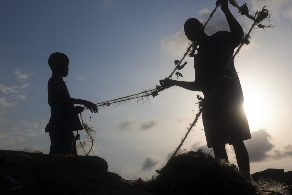
The rising air helps drive the trade winds, which keep the warm water in the west. In the east, near Peru and Ecuador, the same winds push surface water away. Cold water from the depths rises to replace it, bringing nutrients to the surface and supporting fisheries.
But sometimes – roughly every two to seven years, though not on a schedule – the winds weaken. Warm water begins moving eastward, along with rain. As it reaches South America, the thermocline – the boundary between warm surface water and cold deep water – sinks. Upwelling weakens, along with the usual flow of nutrients from below, and fish populations collapse.
How is El Niño forecast?
Long before satellites, people recognized the signs. Andean farmers watched a haze obscure the Pleiades, a clue about coming rains. Peruvian fisherfolk noticed warm seas and collapsing anchovy harvests around Christmas, so they named it El Niño for the Christ child.
Half a world away, the 1877 monsoon failed in India, causing a famine that killed millions. The Crown sought a way to predict seasonal rains. Cambridge mathematician Gilbert Walker found that air pressure in different spots in the tropical Pacific moved in opposite directions. He called this pattern the Southern Oscillation. Scientists later linked those pressure changes to the movement of warm water in the Pacific, calling the phenomenon the El Niño-Southern Oscillation, or ENSO.
Schrag has found signs of the cycle in fossil corals dating back at least 120,000 years. “As long as there’s been a Pacific, there’s been an El Niño,” he said, calling it “an internal mode of variability shaped by the geometry of the Pacific Ocean.”
Today, forecasts draw on a vast observing system. Argo floats, robotic instruments that rise and sink throughout the ocean, measure temperatures at different depths. A network of moorings – the TAO array – watches the region where El Niño begins. Satellites measure sea-surface temperatures and winds. Models combine the observations.
“Once you start seeing that blob of warm water set off toward the east, it’s strongly predictive,” Huybers said, noting that forecasts become accurate between six and 12 months out.
Scientists understand how El Niño develops once it is underway better than they understand why a particular event begins. Bursts of westerly winds over the tropical Pacific can help set it in motion. Some studies suggest that large tropical volcanic eruptions can also favor El Niño, but the evidence remains mixed.
How big is this El Niño – and are El Niños getting stronger?
Scientists measure El Niño through sea-surface temperature anomalies – the difference between the current temperature and a long-term average.
As of mid-September 2026, sea-surface temperatures in the eastern equatorial Pacific already indicate strong El Niño conditions. According to the National Oceanic and Atmospheric Administration, a region of the equatorial Pacific known as Niño 3.4 is already 2 degrees Celsius (3.6 degrees Fahrenheit) above average and is forecasted to peak at roughly 3.4 degrees Celsius warmer this winter.
NOAA’s September outlook puts the odds at 75 percent that, from October through December, this El Niño will be hotter and stronger than any since 1950. That forecast uses a relative index that accounts for warmth across the broader tropical oceans, so the record-strength estimate already adjusts for global warming.
A record-breaking event would not, by itself, establish that El Niños are getting stronger over time. Scientists must distinguish an unusually large swing from a lasting change in the cycle. Adjusting for background warming helps make that comparison, but it does not establish whether climate change is altering El Niño itself.
Zhiming Kuang, Gordon McKay Professor of Atmospheric and Environmental Science, said that after removing the trend, the current temperature anomalies indicate “a strong event.”
Where will the impacts be felt?
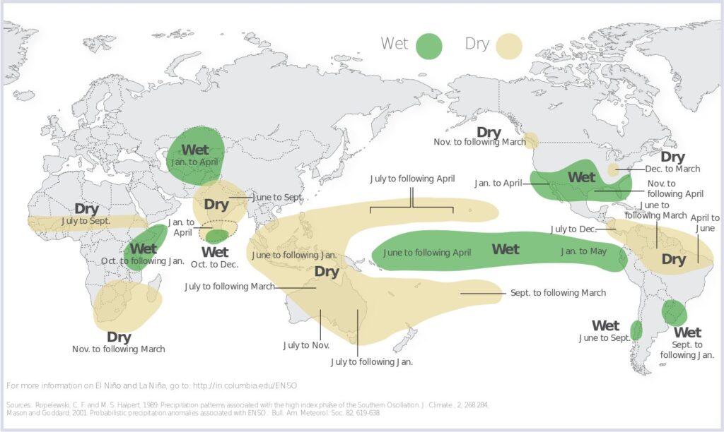
El Niño does not produce one global kind of weather. It shifts the odds from place to place through atmospheric links across distance known as teleconnections.
“El Niño isn’t just a phenomenon isolated to the Pacific, but it correlates with temperature and precipitation across the globe,” said Klara Kuemmerle, a doctoral candidate in the Huybers Group. Because of a variety of interactions, those links tend to coincide with warmer and drier conditions across Southeast Asia and Africa and cooler conditions across South America. Tropical regions often see the largest shifts in precipitation.
Indonesia and Australia tend to turn drier. In Indonesia, reduced rainfall is already fueling peatland fires, and rice production is expected to fall. Southern Africa faces drought risk. Sorghum and maize harvests could suffer, particularly in areas already struggling with water shortages.
India’s monsoon is usually weaker during El Niño years. Kuang cited possible rainfall reduction of 15 percent or more, while warning that the pattern has exceptions.
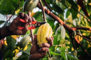
Elsewhere, the problem can be too much rain. Extreme rainfall could damage cocoa production in Ecuador, while drought could hurt it in West Africa. The economic toll may be greatest where countries rely on rain-fed agriculture and have few alternatives.
In the United States, the southern states tend to be wetter and cooler. El Niño also usually suppresses Atlantic hurricanes by increasing wind shear – differences in wind speed and direction at different altitudes – which can tear developing storms apart. That helps explain why the Atlantic has yet to see a hurricane this year. The tropical Pacific, however, can see more hurricanes, as recent storms near Hawaii have shown.
What does climate change do to El Niño?
By spreading warm water across the tropical Pacific, sending more heat into the atmosphere, and shifting rainfall patterns, strong El Niño events raise global temperatures. But a single El Niño year is not a perfect preview of the hotter future.
“The very structure of how El Niño influences the globe is changing with global warming,” Huybers said.
Whether climate change is changing El Niño itself remains unsettled. Researchers cannot yet say whether the events are becoming more frequent or more powerful. Recent El Niños have been large, but the instrumental record is short, and climate models struggle to simulate ENSO.
Scientists are also studying whether strong El Niño events could amplify other climate feedbacks. Warmer Arctic winters, for example, could accelerate permafrost thaw.
Can communities prepare?
El Niño offers advance warning of some typical patterns: Certain regions tend to be wetter or drier, hotter or cooler. Forecasters expect those patterns again this year, with the tropics likely to feel the effects most directly.
But Huybers also expects unfamiliar effects that will be harder to predict. Unfolding on top of a long-term warming trend, he said, this event could produce “novel effects” and make for “a weird year.”
“Weirdness in general engenders risk,” Huybers added. “We’re going to be seeing all sorts of risks play out.”
-As told to David Trilling