An audit from orbit: Satellites help countries count the methane they miss
Counting cows is easier than measuring the methane they belch. It’s the same with oil wells, landfills, and rice paddies. Officials tallying a nation’s greenhouse gas emissions typically use “bottom-up” figures by multiplying the number of cows or barrels of crude by an estimate of how much methane each produces.
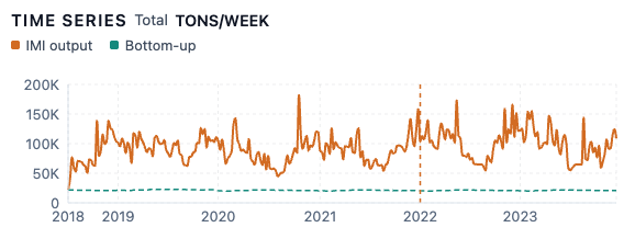
A new tool developed at Harvard is helping countries get a more accurate count ahead of an important deadline. The Integrated Methane Inversion (IMI) starts with a national inventory and uses weather data to calculate where the methane would travel. It compares that prediction with top-down satellite measurements of methane in the atmosphere, then adjusts the estimates to get a closer match.
By combining satellite and on-the-ground measurements, the IMI may tell officials that “your cows are emitting more methane than you think,” said Daniel Jacob, the Vasco McCoy Family Professor of Atmospheric Chemistry and Environmental Engineering.
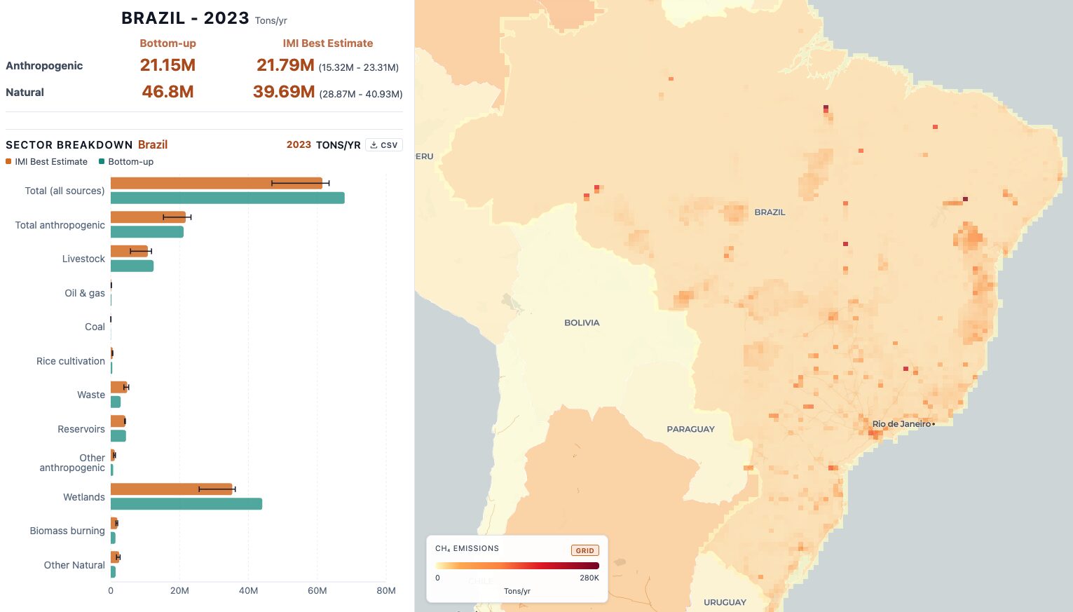
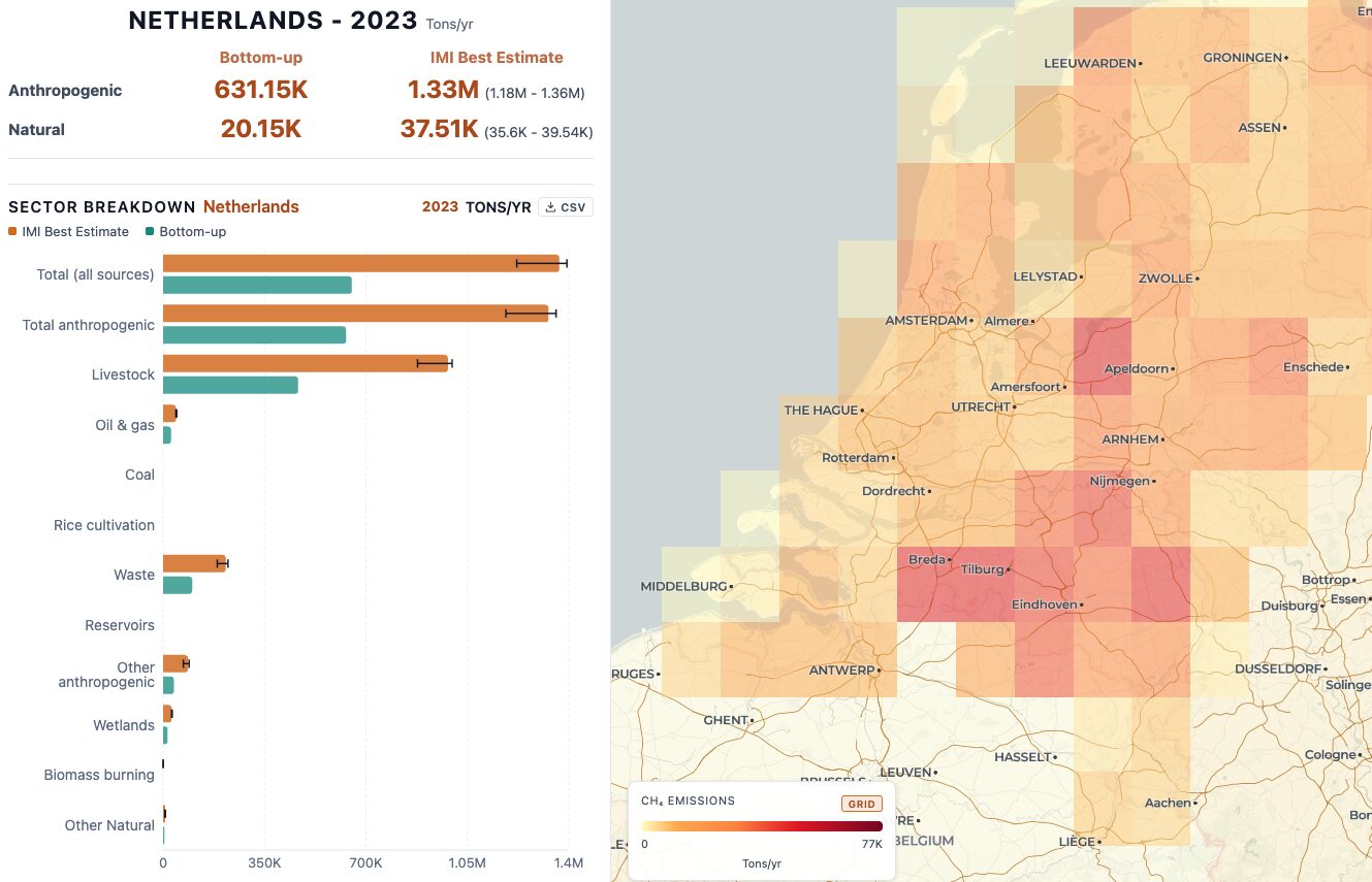
For example, Brazil’s livestock estimates closely match the IMI analysis for 2023, while for Argentina, the IMI estimate is significantly higher. Jacob attributes the gap to Argentina’s lower estimate of methane released per cow. Kazakhstan, on the other hand, appears to be overestimating its livestock emissions and underestimating the methane released during oil and gas drilling. And in The Netherlands, the IMI shows methane emissions, largely from livestock, almost twice what the country counts.
A UN deadline approaches
Methane accounts for roughly 30 percent of global warming since industrialization. Pound for pound, it traps about 80 times as much heat as carbon dioxide. But methane lasts only about a decade in the atmosphere, while some carbon dioxide persists for centuries or longer. Cutting methane emissions can therefore slow warming relatively quickly.
Most countries in the Paris Agreement must report their greenhouse gas emissions and progress toward their climate pledges to the United Nations every two years. These biennial transparency reports are next due on December 31 (and, for most countries, will include data through 2024).
“If the Paris Agreement is going to have any effect on tackling climate change, there has to be an accurate accounting of what’s been achieved compared to what was pledged,” said Robert Stavins, the A.J. Meyer Professor of Energy & Economic Development at Harvard Kennedy School.
Overall, a study led by Harvard postdoc James East used the IMI to estimate that human activities globally released about 15 percent more methane in 2023 than countries’ UN reports indicated.
Stavins and Jacob are preparing assessments for over 40 of the largest methane emitters, using national inventories and IMI data for 2023 and 2024. They will discuss the findings with country delegations at the UN COP31 climate talks in Antalya, Turkey, from November 9 to 20.
Bottom-up plus top-down
Satellite measurements of methane have improved rapidly in recent years.
The IMI uses the TROPOMI instrument, which is unique in detecting total atmospheric methane worldwide, allowing the IMI to quantify emissions in areas as small as 12 kilometers across. But detecting methane and identifying its source are different tasks. Where cattle, landfills, oil and gas extraction, and wetlands share a landscape, satellites alone cannot reliably separate their contributions.
“We can’t do it all from space,” Jacob said. Researchers need information from national inventory teams to connect the satellite observations to specific activities. “This is why I insist that we’re partners to the bottom-up teams.”
Indeed, the satellite estimates have uncertainties of their own. Clouds limit satellite coverage, and the results depend on how well the model tracks methane through the atmosphere and how accurately inventories locate its sources. Indonesia is especially challenging, Jacob said: persistent clouds and surrounding ocean (which can reflect too little of the infrared light TROPOMI needs to measure methane) leave fewer usable satellite observations. The researchers publish an uncertainty range alongside their estimates.
Using a common method makes the results easier to compare across countries. The software is public and an interactive website lets users explore the findings.
More than reported
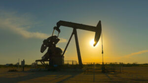
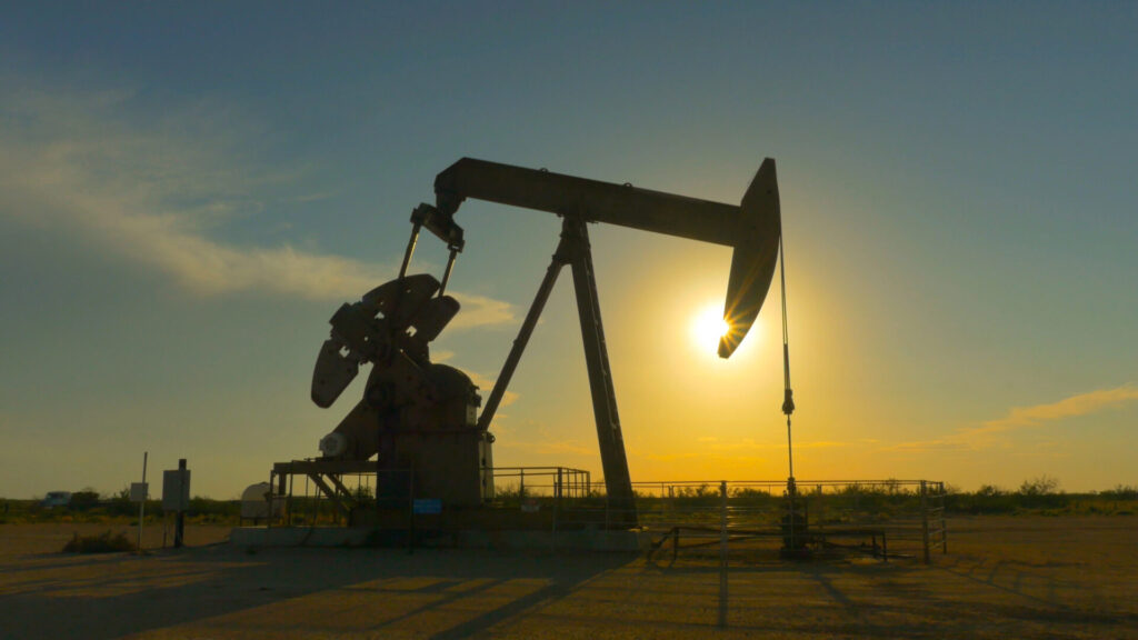
Last week, the Trump administration proposed weakening rules designed to reduce methane leaks from oil and gas production—a major source of undercounting in the United States. Methane is the main component of natural gas, and how much escapes depends heavily on operating practices. Standard assumptions in emissions inventories can miss those differences.
The Permian Basin, which straddles Texas and New Mexico, illustrates how emissions can vary within the same oil and gas region. Methane intensity—the amount of methane emitted per unit of oil and gas produced—is lower in New Mexico, which may reflect how the state regulates operations or different practices by different producers.
When better counting looks worse
For governments, a revised total is only a start. It cannot tell a ministry which regulation to change or an operator which valve to repair.
Stavins has already discussed the work with officials from the European Commission. “They’re eager to talk,” he said. He does not expect every government to be as receptive.
Because better accounting can be politically awkward. A country may look like a bigger polluter even if its emissions have not risen. But the higher figure may simply mean more of the methane escaping from farms, landfills, and oil fields has been counted. A more accurate starting point gives officials a firmer basis for judging whether their efforts to cut emissions are working.