get the brief in your inbox
SubscribeAfrica’s rising seas, mapped and measured coast-to-coast
The seas are rising everywhere. But they are not rising everywhere for the same reasons.
Along any stretch of coastline, sea-level rise is shaped by a unique combination of overlapping forces: warming water that expands, melting ice that adds mass to the ocean and alters gravity, shifting currents, and land that is itself moving up or down.
By reconstructing the causes of past sea-level rise locally – and measuring how much faster the rise is happening today than it was a few decades ago – scientists are helping policymakers confront excruciating choices about where to build protections and, in some cases, what land should be abandoned.
A new interactive tool visualizes those causes all around the African coastline, looking back to 1900 and ahead to 2100 and helping fill one of Africa’s major climate-data gaps. “Tide gauge records are sparse and discontinuous across most African coasts,” said Rebecca Berkoh-Oforiwaa, a postdoctoral fellow in atmospheric physics. “These gaps present a critical challenge for climate-adaptation planning.”
The tool maps 950 coastal locations around Africa. Click any point to see how much sea level has changed, which physical processes are driving the change, and how much sea level could rise under different emissions scenarios.
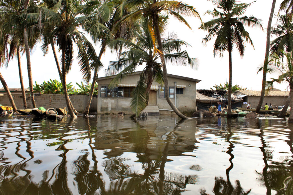
The tool shows the stakes, for example, in the Gulf of Guinea, where an interdisciplinary Harvard-supported team is studying rapid population growth alongside some of the world’s most extreme coastal erosion. Since the mid-20th century, rates of sea-level rise have tripled between Côte d’Ivoire and Nigeria, driven largely by ice melt and because warming waters expand in volume.
“It’s a tool for the general public, but it’s also a tool for people who are interested in adaptation policies,” said Jerry Mitrovica, a geophysicist whose lab developed the tool. “This is the first time these results have been visualized at local scale in such an accessible way.”
Filling gaps
The tool adopts research led by Sönke Dangendorf of Tulane University. By bringing multiple statistical approaches together, Dangendorf’s model allowed Mitrovica’s team to map sea-level change across a large region in unprecedented detail.
The reconstructions draw on long-running tide-gauge data, some with records stretching back more than a century. But the farther back the record goes, the sparser the observations become. The model addresses that gap by combining scattered measurements with the physics of how sea level changes across space and time. A single tide gauge cannot describe an entire coastline. But because processes such as ice melt and thermal expansion produce distinct geographic patterns, even scattered observations can help constrain what happened nearby.
“Going back to 1900 is possible both because you have tide gauges and because you have these physical models of how sea level changes,” said Gabe Cederberg, who designed the tool.
The result is a reconstruction with the largest uncertainty in the early 20th century, narrowing in more recent decades as satellite records and other modern observations come online.
Going local: Where reconstruction and observation diverge
Where reliable local measurements exist, researchers can compare them with the reconstructed sea-level record. Most of the time, the two track closely. When they do not, the gap can reveal a local process that the broader reconstruction does not include.
For an illustrative example, take Venice. A global reconstruction captures the broader sea-level trend in the Adriatic Sea. But tide-gauge data from the Venice Lagoon also reflect groundwater pumping in the 1970s and ‘80s, when the city’s sinking accelerated. That subsidence made relative sea-level rise happen faster than the regional reconstruction alone would suggest.
“That discrepancy is telling you something about local impacts that you’re not seeing in the reconstruction,” Mitrovica said. “Most often, when comparing the global statistics, the observations are going to fit one-to-one. But in those places where they don’t fit, like Venice, there’s something local going on.”
The same logic applies to African coastlines, even when data are sparser. Earthquakes, sediment compaction, groundwater withdrawal, and other forms of vertical land motion do not change the global ocean, but they can sharply change what a community experiences on its coast.
Projections and policy implications
The tool’s projection view shows relative sea-level change through the year 2100 under three emissions pathways representing different possible futures, from lower to higher greenhouse-gas emissions.
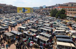
For Berkoh-Oforiwaa, the tool provides a “critical baseline for interpreting projected future changes,” especially in coastal megacities like Lagos, Nigeria, where rapid urbanization and groundwater pumping appear to be causing land to sink and adding to relative sea-level rise.
By separating regional trends from the local forces that can make flooding worse in a particular place, scientists can help policymakers develop targeted interventions. In some cities, that might mean piping in drinking water rather than pumping it from aquifers. It might mean addressing demographic pressures: poverty and government underinvestment cause people to leave rural regions for the heaving coasts. And it might mean evacuating some regions as coastal flooding accelerates further.
“Reliable and comprehensive sea-level data are essential for developing informed policies to mitigate coastal hazards,” Berkoh-Oforiwaa said.
-As told to David Trilling