How Regulators Use Satellite Images of Methane
Regulators are giving methane a closer look – from above.
Methane is far more efficient at trapping heat than carbon dioxide. Fortunately, the greenhouse gas – a byproduct of fossil fuel extraction, agriculture, waste management and more – has a much shorter half-life. So, efforts to reduce emissions could be a powerful lever to mitigate near-term climate change.
But a lack of detailed information about invisible leaks has stymied governments trying to clean up.
Traditionally, governments have measured methane emissions using bottom-up methodologies; they calculate totals based on the activities that cause emissions – how many tons of coal are mined, for example, or how many cows are on a ranch – multiplied by an estimate of how much each ton or cow emits. But these approximations are subject to large uncertainties; every ton of coal is different, as is every cow’s digestive tract.
As a result, national emission totals exhibit large ranges. Estimates of methane emissions from oil and gas production vary by an order of magnitude in countries like Russia, Uzbekistan, and Venezuela. Yet these are the figures nations report to the United Nations Framework Convention on Climate Change, and which will be discussed at the Conference of the Parties (COP28) opening next month in Dubai.
More accurate data can be generated by comparing those bottom-up numbers with top-down estimates that draw on new remote sensing technology – infrared images taken by sensors aboard airplanes and satellites. At an October 12 research workshop, two members of the Reducing Global Methane Emissions research cluster sponsored by Harvard University’s Salata Institute for Climate and Sustainability discussed how to use these tools to rewrite regulations.
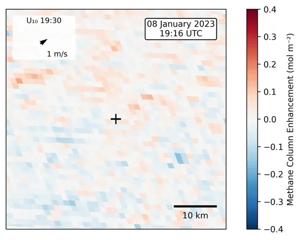
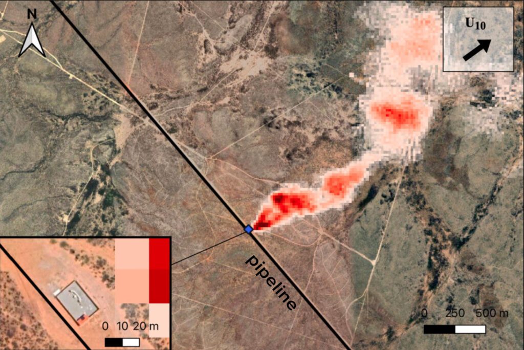
“The atmosphere doesn’t lie,” said Daniel Jacob, the Vasco McCoy Family Professor of Atmospheric Chemistry and Environmental Engineering, as he showed satellite infrared images of Texan leaks happening in short, but intense bursts that are likely missed by the bottom-up approach. “Satellites are particularly useful because they provide global and continuous observations. Methane can’t hide. I can see it anywhere on earth, even in countries that may not want us to know how much methane they’re emitting.”
In the Permian Basin of Texas and New Mexico, daily satellite observations show that emissions vary week-to-week, and often track changes on the ground, like a fall in the price of natural gas (methane is the main component in natural gas, which some producers vent into the atmosphere when it is more costly to capture it for market). “It turns out the industry responds very quickly to price changes and starts emitting gas,” Jacob said. “We think a lot of these large emission events that have been attributed to leaks are instead due to deliberate venting, which means also that we can do something about it.”
The intermittency of emissions is a challenge for regulators, explained Carrie Jenks, the Executive Director of the Environmental and Energy Law Program at Harvard Law School.
“We are looking at how to design regulations in the absence of perfect knowledge,” Jenks said. “The technology is advancing faster than the regulatory process. So, the other question that we’re addressing is how to design a regulation that can keep up with technological advancement.”
Because bottom-up calculations can overlook many variables, the 2022 Inflation Reduction Act (IRA) instructed the Environmental Protection Agency to include more empirical analysis and data. As the EPA solicits ideas, the Environmental and Energy Law Program is bringing together non-governmental watchdogs, academics and oil and gas operators to consider how regulations could be designed to create incentives for firms to better identify and repair methane leaks and one-time releases, and therefore reduce emissions.
“We’ve been trying to help the EPA and stakeholders think through all the questions: How can you make the most-durable rule? How can you make it stick? How can you make sure that companies can implement it? How do you make sure courts uphold it? And how do you make sure that agencies can enforce it?” said Jenks.
Another EPA rule implementing a provision of the IRA will impose a fee on each ton of methane emitted based on the bottom-up analysis. However, the IRA eliminates the fee once all states submit plans that EPA approves.
“If the fee goes away after all states submit a plan, the politics start to shift as you will have companies pushing their states to submit plans to comply so they don’t have to pay a fee,” explained Jenks.
Jenks is optimistic the new rules will work in part because of public pressure campaigns that are tapping into increasingly available satellite data. “Because you’ve got companies that are coming forward to reduce emissions and you have NGOs and third parties who will be releasing data based on satellites and other technologies, we will be able to better understand the actions companies are taking to reduce emissions and where more action is needed.”
Indeed, the data Jacob and his team are collecting will ultimately become public, allowing stakeholders to do their own analysis: “They don’t have to take our word for it,” he said.